South Dakota’s Winter Outlook: How La Niña Could Bring a Deep Freeze
When it comes to winter in South Dakota, a look into the future is always welcome. Having a heads-up on what we will be facing is always a good thing.
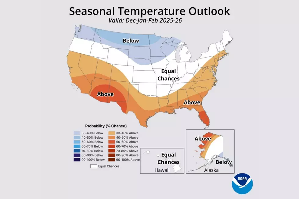
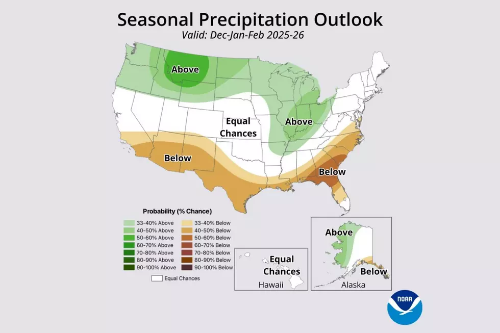
We've got the predictions from the Farmer's Almanac, and now we're getting a look at what the good folks at the National Weather Service have to say. NOAA’s National Weather Service Winter Outlook has been released, and the major factor influencing our winter looks to be La Niña.
The National Weather Service Office in Sioux Falls says that for the Sioux Empire, this means, "...weak La Nina conditions are expected to bring higher chances for below normal temperatures and equal to higher chances for above normal precipitation."

What is La Niña?
La Niña is part of the El Niño weather phenomenon, which involves changes in winds and ocean surface temperatures in the Pacific Ocean. El Niño is the warming phase, and La Niña is the cooling phase.
La Niña disrupts global weather, often causing short-term cooling and intense storms. For us in southeast South Dakota, our chances of an especially cold winter increase.
Sioux Falls Snow Records
More From Hot 104.7 - KKLS-FM