
Heavy Rain Tonight Is a Remnant from Tropical Storm – Rare For These Parts
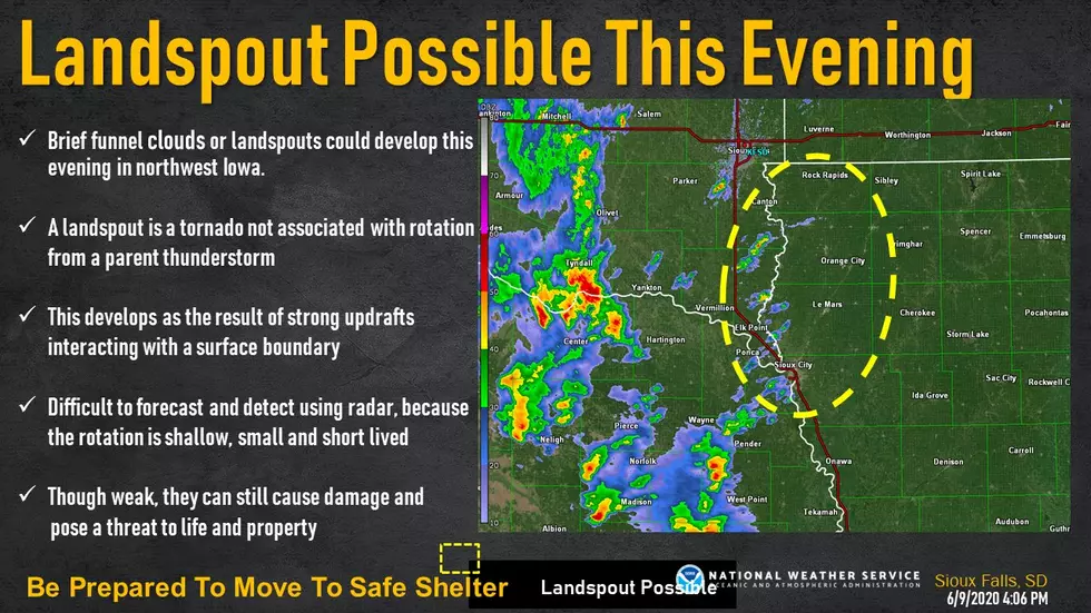
Look to the south and east tonight and you could see something rare. Landspouts - otherwise known as funnel clouds - could form over the area bringing heavy rains and strong winds to the area.
Looking to the east from Sioux Falls, you can see clouds from the remnants of Tropical Storm Cristobal. It's producing heavy rain to parts of MN, IA, and WI. This is a pretty rare event for the leftovers of a tropical system to come this far north! ~ Dakota News Now Meteorologist, Phil Schreck.
Are landspouts dangerous? According to Accuweather, landspouts tend to be very weak and short-lived lasting for only a few minutes. However, they can be strong enough to cause some damage, typically what is equivalent to an EF-0 tornado.
As for Tropical Storm Cristobal, it is beginning to weaken in the gulf but the remnants are reaching far north, a rare event in the Dakotas.

Think you Know Sioux Falls Parks? Can you Guess Which Park is Which Just by Looking at These Images?
More From Hot 104.7 - KKLS-FM
