Canadian Wildfire Smoke Now Darkening Skies Over Minnesota
Many Northlanders may look to get out and enjoy what is forecasted to be a beautiful start to the week. With the forecast calling for clear sky and summerlike temperatures, plenty of people will be looking for reasons to spend time outside.

While the forecast continues to call for a pretty clear day as far as cloud cover goes, you may notice some hazy conditions throughout the day on Monday. These hazy conditions aren't just high-level clouds.
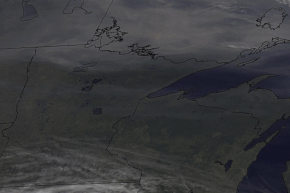
The milky haze extending over Northern Minnesota and Wisconsin as well as Lake Superior, the Michigan UP, and Canada seen in the satellite image below is smoke from wildfires.
The Duluth office of the National Weather Service points out that these hazy conditions that might filter out some of today's sun are from wildfires out west and in Canada, which can more clearly be seen in this smoke plume map photo from the website AirNow, which monitors air quality.
The darker gray areas are indicative of heavier smoke coverage stemming from plumes originating from fires in Alberta, British Colombia, and elsewhere out west. The current airflow has the densest coverage from this smoke staying north, into Canada, however, it is drifting into northern portions of border states like Minnesota, North Dakota, Wisconsin, and Michigan.
The Duluth office of the National Weather Service says that Monday's smoke impacts will mostly be visual only, with no significant air quality impacts anticipated at this time. This can, of course, change as wind and weather conditions change.


